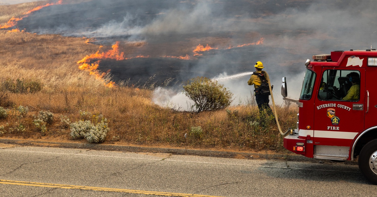
TUESDAY, OCTOBER 6, 2026 — Three separate fires burning south of Lake Perris merged into one wildfire Tuesday afternoon, the Pico Fire, burning about 100 acres across flat terrain and a hillside. The blaze was reported at 11:56 a.m. near Ramona Expressway and Pico Avenue in Nuevo, a rural community east of Lake Perris and the city of Perris in Riverside County, according to Cal Fire’s Riverside County Unit, as reported by the Palm Springs Desert Sun.
The fire has the potential to grow to 500 acres, according to Watch Duty, the wildfire-tracking app that draws on firefighters’ radio traffic and other sources. About 100 firefighters were assigned to the blaze Tuesday afternoon, including eight engines, three hand crews and a helicopter, Cal Fire reported — and additional engines have been requested as crews work the lines.
The closureRamona Expressway shut down
Ramona Expressway was closed between Lakeview Drive and Rider Street, according to the City of Perris. The closure cuts a key east-west route through the Perris Valley, and drivers were being routed around the area as crews fought the fire through the afternoon.
The responseBuilding containment through the night
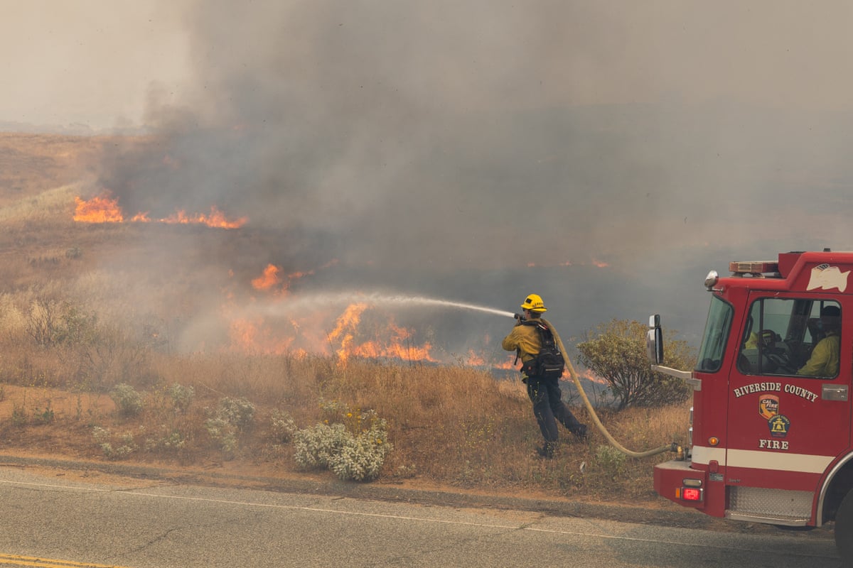
Firefighters were expected to remain on scene through the night, cutting containment lines around the 100-acre footprint. The incident command scaled up fast: roughly 100 personnel on the assignment, with air support from a helicopter working the hillside flank. Additional engines were requested as crews braced for the afternoon — when heat and wind typically push these fires hardest. The cause of the fire had not been reported as of early Tuesday afternoon, and containment figures had not yet been released.
The corridorWhere the fire sits on the map
Nuevo is a rural community of scattered homes and open land east of Lake Perris, and the fire’s origin point — near Ramona Expressway and Pico Avenue — puts it squarely in a corridor that feeds commuters between Perris and San Jacinto. The closure between Lakeview Drive and Rider Street shuts a key east-west artery through the Perris Valley; drivers coming off the 215 freeway toward Hemet or San Jacinto faced detours through the afternoon, with the City of Perris publishing the closure.

The riskNo evacuations — and how to stay ready if that changes
No evacuation orders or warnings were in place as of early Tuesday afternoon, the Desert Sun reported — but evacuation boundaries can change in minutes during a wildfire, and the fire’s potential to grow to 500 acres means residents downwind should stay alert. Real-time alerts are available through Genasys Protect at protect.genasys.com or through its mobile app, where tapping a zone shows the streets and landmarks that define evacuation warning or order boundaries. General preparedness guidance from fire officials: know two ways out of your neighborhood, keep a go-bag with medications, documents and chargers by the door, and sign up for Riverside County’s alert system before smoke is on the horizon — not after.
The seasonSouthern California stays on alert
The Pico Fire is the latest blaze in a busy fire stretch for Riverside County. Earlier this month, the Bouquet Fire near Santa Clarita swelled past 800 acres with mandatory evacuations — a reminder of how fast these fires can move once they take hold. The next updates to watch for on the Pico Fire: a first containment figure, whether the 500-acre potential materializes, and whether any evacuation warnings follow the road closure.
The alertsOrder vs. warning — know the difference now
Because the Pico Fire’s status can shift fast, it helps to know the language before an alert arrives. An evacuation order means leave immediately — conditions are dangerous in your zone. An evacuation warning means be ready to leave — conditions are developing and an order could follow. Those are the standard definitions used across California’s emergency alert systems. As of early Tuesday afternoon, the Pico Fire had triggered neither — but with roughly 100 acres burned and 500 acres possible, zones near Ramona Expressway and the surrounding neighborhoods are the ones to watch.
The best way to track a specific fire is through the sources closest to it: Cal Fire’s Riverside County Unit for incident reporting, the Watch Duty app for near-real-time updates drawn from radio traffic and official sources, Genasys Protect for precise evacuation-zone maps, and the Desert Sun, which is updating its Pico Fire coverage as the afternoon develops. If you see smoke or flames near your home, call 911 — do not wait for an alert.
What’s nextThe next numbers that matter
Three figures will tell the story of this fire over the next 24 hours. First, a containment percentage — not yet reported as of early Tuesday afternoon — which measures how much of the fire’s edge firefighters have locked in with line. Second, the acreage, and whether the current 100 acres holds or stretches toward Watch Duty’s 500-acre potential as the afternoon and evening unfold. Third, whether any evacuation warnings follow the Ramona Expressway closure. Investigators will also be looking into the cause — unreported so far — including how three separate fires ignited close enough to merge. Previously will update this story as those numbers come in.
Sources
- Palm Springs Desert Sun “Pico Fire in Riverside County grows to 100 acres; road closed” — size, location, resources, road closure, evacuation status
- Cal Fire Riverside County Unit via Desert Sun — initial report time, location, engine/crew/helicopter assignment
- Watch Duty via Desert Sun — 500-acre growth potential estimate