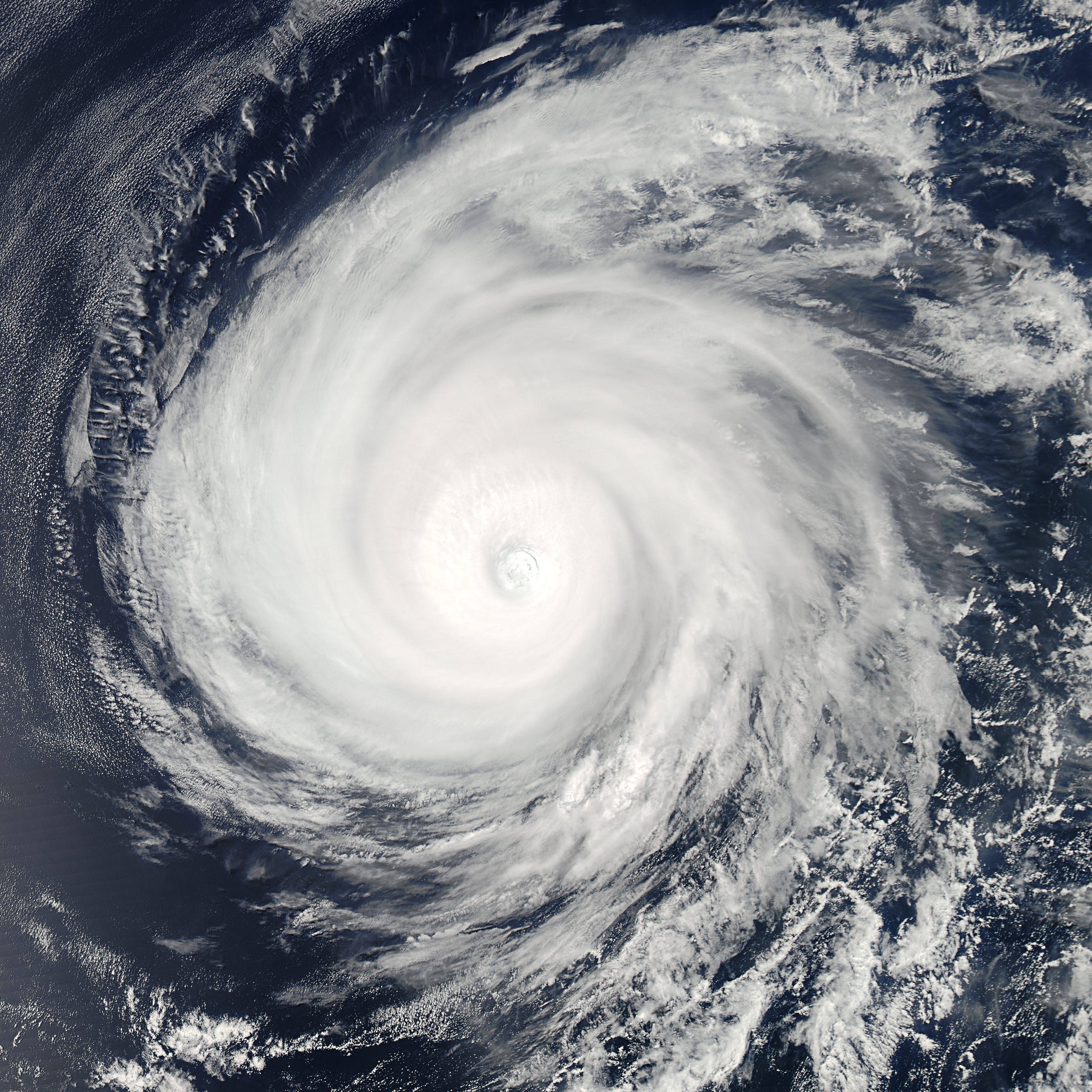

There is a particular kind of dread that comes with a slow hurricane. A fast storm hits, screams past, and leaves people to count the damage in daylight. Hurricane Simon has done almost the opposite. Through Sunday, October 11, and into Monday, October 12, the Category 4 storm has crawled along Mexico's west-central Pacific coast, close enough to punish the shoreline for hours, and uncertain enough that forecasters could not promise whether its center would cross inland or stay tantalizingly, dangerously, just offshore.
That uncertainty is not a comfort. It is the whole problem. The National Hurricane Center expected Simon to move very near the coast late Sunday and remain close on Monday, and its guidance was blunt about what proximity alone can do: dangerous storm surge, large and destructive waves, and damaging winds are likely along a stretch of coast that includes busy port cities, resort towns and mountainous terrain that does not forgive heavy rain.
Where Simon was, and how strong it got
In its advisory at 9 a.m. local time on Sunday, the hurricane center placed Simon about 105 kilometers — 65 miles — west-northwest of Manzanillo, in the state of Colima. Its maximum sustained winds were measured at 230 kilometers per hour, or 145 miles per hour, solidly in Category 4 territory. The storm was moving north-northwest at only 11 kilometers per hour, about 7 miles per hour, with its center roughly 140 kilometers, or 85 miles, south-southeast of Cabo Corrientes in Jalisco.
Those numbers were, if anything, a slight step down from the storm's peak readings. Earlier reconnaissance had measured a central pressure of 932 millibars and winds near 150 miles per hour, while the storm crawled at roughly 5 miles per hour. You do not need to be a meteorologist to read 932 millibars and feel your stomach drop. That is a deep, powerful cyclone, and the slow forward speed means the communities underneath its outer bands do not get a quick pass — they get a long, grinding exposure to wind and water.
The core of the storm was expected over or near Puerto Vallarta on Sunday, a detail that raises the stakes considerably. Forecasters noted Simon could become the strongest hurricane to affect Puerto Vallarta since Hurricane Lidia in October 2023. Anyone who lived through Lidia, or watched it from afar, knows that comparison is not offered casually. It is a warning dressed up as context.
Warnings, alerts and a president telling people to stay inside
A hurricane warning was in effect from Punta San Telmo to El Roblito, including the Islas Marias, while a tropical storm watch extended east toward Lazaro Cardenas. Warnings on a map can look abstract until you translate them into what officials were actually doing on the ground.
Mexico's civil protection agency, the CNPC, placed 28 municipalities across Jalisco and Colima at its highest alert level, with another 93 municipalities at high alert. That is not a handful of beach towns being told to tie down the patio furniture. That is a broad, coordinated posture across two states, built for the possibility of a major landfalling hurricane.
President Claudia Sheinbaum used a post on X to urge coastal residents in Jalisco, Colima, Nayarit and Michoacan to stay sheltered until authorities say the danger has passed. Precautionary evacuations were continuing, emergency shelters were opened, nonessential activities were suspended, and Puerto Vallarta's international airport was temporarily closed. In other words, a region that runs on tourism, shipping and open-air daily life was told, in unison: stop, get inside, and wait.
There is something quietly admirable about how quickly that machinery can move when it has to — shelters open, airports close, alerts stack up municipality by municipality. But machinery only works if people listen, and the president's message was aimed precisely at the gap between an official alert and a resident deciding the sky does not look that bad yet. With a storm this slow, the sky has plenty of time to change its mind.
The rain may be the most dangerous part
Wind gets the headline in a Category 4, and 145-mile-per-hour sustained winds have earned it. Key messages carried by The Weather Channel and the hurricane center warned of catastrophic wind damage and life-threatening surge for a portion of the coast. Still, the figure that should haunt anyone looking at a topographic map of Jalisco and Colima is the rainfall total: up to 30 inches possible in places.
Thirty inches of rain does not fall evenly, and it does not need to. In mountainous terrain, that water concentrates fast — into arroyos, into hillsides that have been loosened, into communities built below slopes that hold until, suddenly, they do not. Forecasters flagged a serious landslide risk, and it is easy to understand why. A slow-moving storm is a rain-making machine parked over ground that can only absorb so much.
Then there is the ocean itself. Storm surge and large, destructive waves were expected along the coast whether or not the center technically makes landfall. That distinction — landfall or no landfall — matters enormously to record books and very little to a waterfront neighborhood. If the water rises and the waves are tearing at the shore for hours, the storm has arrived in every way that counts, whatever the official track line says.
Manzanillo, the working coast, waits
One of the more striking details from the weekend was the mood in Manzanillo. The city is Mexico's largest port and its main gateway for trade with Asia — a place where a closure or a battering is not just a local story but a supply-chain story. Yet residents there appeared largely calm on Saturday as Simon approached offshore.
Calm can be experience. Pacific Mexico knows hurricanes the way the Gulf Coast knows them: as a season, not a surprise. But calm can also curdle if a storm lingers, and Simon's defining trait so far has been lingering. A port city can prepare cranes, containers and crews; it cannot negotiate with surge.
For Puerto Vallarta, the stakes are different but no less real. A temporarily closed airport and suspended activities mean visitors sheltered in hotels and residents sheltered at home, all watching the same gray horizon, all waiting for officials to say the word. If Simon does prove to be the strongest storm to affect the city since Lidia, the recovery conversation will start the moment the wind drops — and Puerto Vallarta has shown before that it knows how to have that conversation and get back on its feet.
What happens after Simon
The story does not end at the Mexican coast. Forecasters noted that remnant moisture from Simon could stream into the central United States on Tuesday and Wednesday, boosting heavy rain and thunderstorms there. It is a familiar pattern — a Pacific hurricane's second act playing out hundreds of miles inland, in places that never saw the storm's name in a warning.
For now, though, the story is the coast itself: Jalisco, Colima, Nayarit and Michoacan, sheltered and waiting, while a Category 4 hurricane decides, at walking pace, exactly where it wants to go. The official advice has been consistent from the president down to local civil protection: stay sheltered until authorities declare the danger passed. With surge, waves and up to 30 inches of rain in the forecast, that is not caution for its own sake. It is the only sensible response to a storm that has already made clear it is in no hurry to leave.
Previously will continue following Simon's track and the official response. For more coverage, see our News desk and the latest on the Previously homepage.