KATHMANDU, NEPAL, SUNDAY, OCTOBER 4, 2026 — A little more than a month after a collapsing glacier and a wall of rock killed more than 1,400 people in the worst Himalayan disaster in years, Nepal is going to war with its lakes. The country's Centre for Hydrology and Water Resources Research will drain four high-altitude glacial lakes judged among the nation's most dangerous, officials announced this week — a six-year, $50 million effort to defuse the next flood before it happens.
The four lakes — Thulagi, Lower Barun, Lumding Tsho and Hongu II — sit at altitudes of 4,050 to 5,483 metres (13,280 to 18,000 feet) in central and eastern Nepal. They rank among the country's most potentially dangerous glacial lakes, according to a 2020 assessment by the UN Development Programme and the International Centre for Integrated Mountain Development (ICIMOD). Work begins this fiscal year, which runs to mid-July 2027, with design work and detailed studies first.
Canals will drain lake water into nearby rivers "in a regulated manner," expert Subash Tuladhar of the CHWRR told Reuters on Oct. 2, with drainage "through gated structures" to follow after detailed studies. Executive director Sanjeeb Baral said the physical draining could take up to six years to complete. "Our aim is to lower the risk of the lakes breaching their natural dams and reduce the risk of downstream floods," Tuladhar said. The program also includes sensors, a flood forecasting and early-warning system, and resilience work with downstream communities — funded by the Green Climate Fund, UNDP and the Nepali government.
What happened on August 26
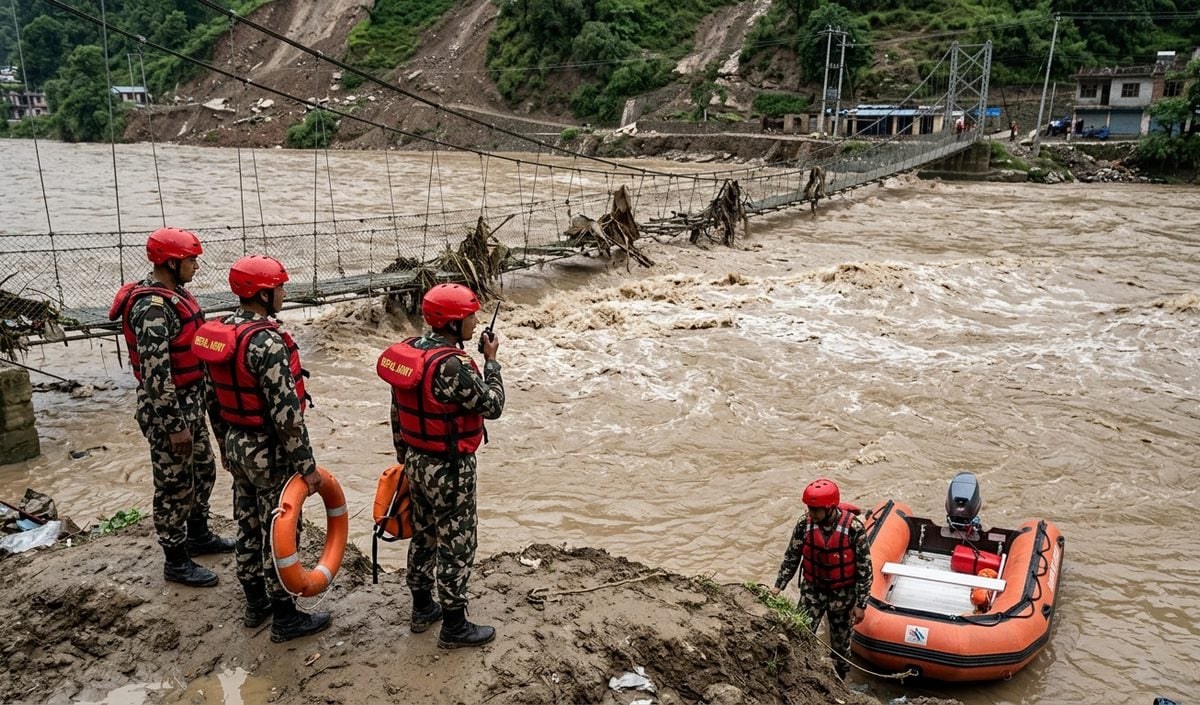
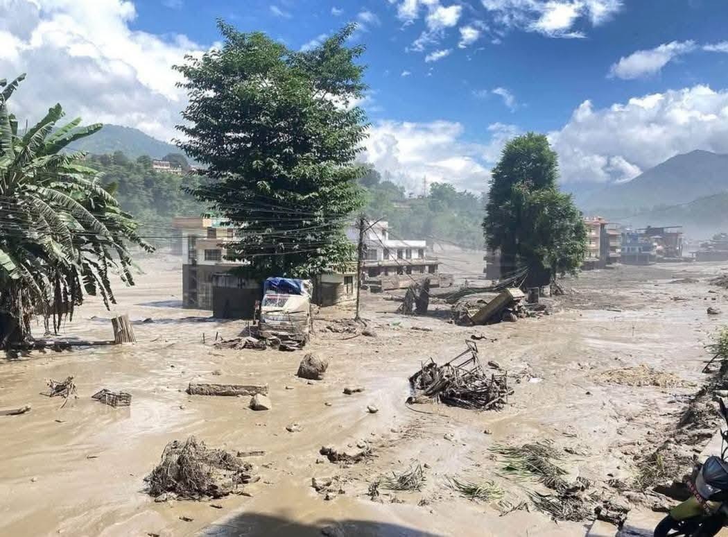
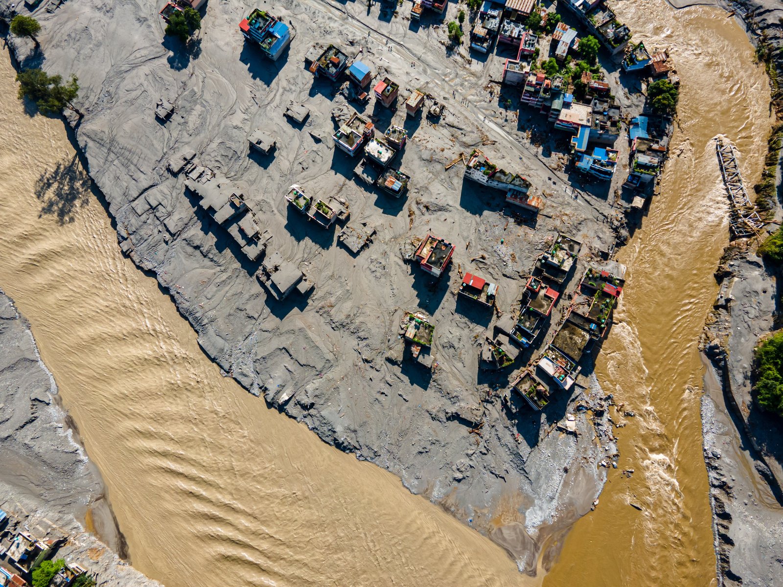
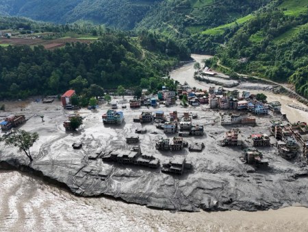
On Aug. 26, 2026, a massive section of the Langtang Lirung glacier — along with bedrock and rock — collapsed near the Nepal–Tibet (China) border. Ice and rock dammed the Lhende river (Lende Khola); when the blockage gave way, a surge of water, ice, boulders, mud and debris tore down the Bhote Koshi–Trishuli corridor, sweeping away villages, around a dozen hydropower projects, roads and bridges. ICIMOD said a snow and rock avalanche from a glacier on the Nepalese side had blocked the Lende Khola — and then suddenly gave way.
The human toll kept rising as search teams worked the debris fields. Nepal's National Disaster Risk Reduction and Management Authority reported at least 1,399 people killed and about 5,200 missing three weeks after the disaster, according to Reuters on Sept. 16. Later updates put the toll at roughly 1,450 dead, with 5,300 to 5,600 missing. Addressing the UN General Assembly in New York on Sept. 24, Prime Minister Balendra Shah said at least 1,400 were confirmed dead and more than 6,000 were missing. The International Organization for Migration, citing the same disaster authority, put the figures at 1,356 dead, nearly 4,900 missing and 84,000 people affected.
The physical destruction was extensive: about 7,500 homes destroyed and some 20,000 damaged; reconstruction needs estimated at NPR 723.3 billion — roughly US$4.7 to 4.8 billion, about a tenth of Nepal's GDP; some 13 hydropower projects damaged, knocking out roughly 759 megawatts of capacity; and a $170 million emergency financing commitment from the World Bank.
A climate fingerprint — but not the disaster you might think
Here is the critical nuance that scientists and the government have stressed: the August disaster was not a glacial lake outburst flood. It was a glacier-and-bedrock collapse that created a landslide dam, which then burst. But it made the argument for draining dangerous glacial lakes more powerfully than any report ever could. According to the AP, a World Weather Attribution analysis released Sept. 17 found human-caused warming "likely helped destabilize the Himalayan slope" — warming thinned glaciers and thawed permafrost, and the 2015 Nepal earthquake may also have weakened the rock. "This disaster was not an extreme weather event, but the fingerprints of climate change are still clear to see in long-term changes," said Ben Clarke, a climate researcher at Imperial College London.
NPR's Sept. 26 reporting from the Trishuli corridor noted it was the third year in a row of deadly floods in that vulnerable valley. Tunneling expert Arnold Dix, describing hydropower plants that simply vanished, said: "Like, they're just not there." And disaster-risk researcher Austin Lord of the Stimson Center told NPR: "This, in particular, is a really high-risk area to build dams. But nonetheless, the industry started there, and it gained momentum."
At the UN, Prime Minister Shah turned the disaster into a climate-justice plea: "When a climate-driven disaster destroys infrastructure of a poor country, the answer cannot simply be another mega loan or a patchwork of small grants. We need adequate grant-based support from the world." He called the Bhotekoshi-Trishuli disaster "a warning to the world" and asked: "have we really heard that warning?" Helene Fors, the IOM's chief of mission in Nepal, said the immediate shock had been followed by "immense uncertainty about their next steps" for thousands of families, stressing that humanitarian action must be "guided by reliable information" so aid reaches those who need it most.
What a GLOF is, and why Nepal is so exposed
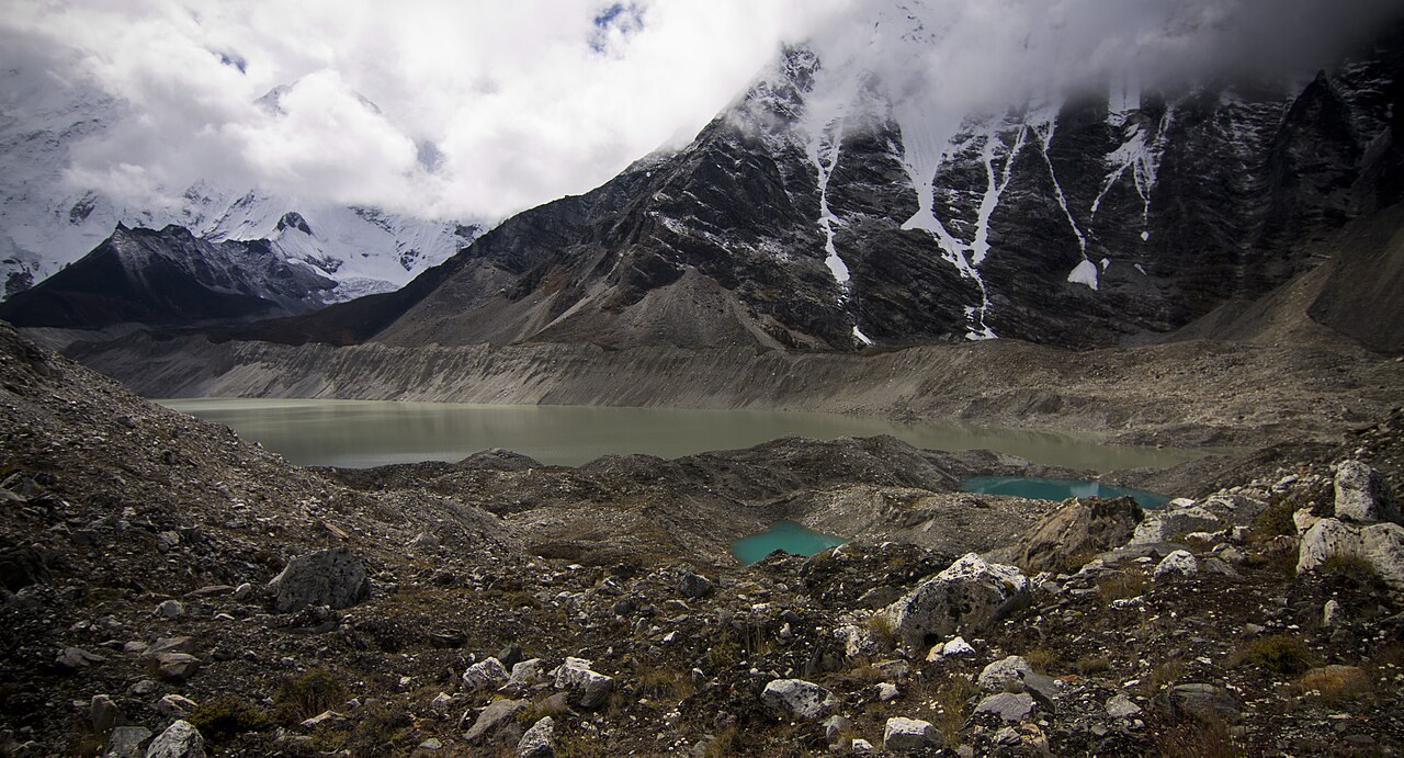
Glacial lakes form behind the unstable moraine walls that retreating glaciers leave behind; if the natural dam breaches, a huge volume of water and debris pours downstream — a glacial lake outburst flood, or GLOF — with catastrophic effects downstream, as ICIMOD's glacier inventory explains. Nepal has recorded about 26 GLOFs in four decades, according to The Insight International. An ICIMOD assessment identified 47 potentially dangerous glacial lakes across Himalayan river corridors — 21 inside Nepal and 25 transboundary in Tibet — with Lower Barun, Thulagi, Lumding Tsho, Hongu II, Tsho Rolpa and Imja Tsho among the highest priority for urgent lake-lowering. A 2009/10 ICIMOD inventory counted 1,466 glacial lakes in Nepal, 21 of them classified as critical or potentially dangerous.
Nepal has done this before: about a decade ago it lowered Imja Lake near Mount Everest, the precedent this new and far more ambitious program builds on. But four lakes at up to 5,483 metres, $50 million, six years, and a corridor full of villages and hydropower plants — this is climate adaptation at the roof of the world, and the whole Himalaya is watching.
One caution on the numbers: late-September monsoon floods (Sept. 24–29) killed at least 27 people with four missing, per the Prime Minister's Office — Nepal Police later put it at 35 dead — and a Sept. 27 avalanche on Himlung Himal killed 11 expedition support workers with five missing. Those are separate events from the August disaster; the lake-drainage plan is a direct response to the August catastrophe and the GLOF risk it spotlighted.
Our disaster desk is tracking the Bouquet Fire in Southern California, and the newsroom has the rest of this morning's world coverage.
Sources
- Nepal Plans to Drain Four Glacial Lakes After Deadly Floods Reuters (Gopal Sharma, Kathmandu) · Oct 2, 2026
- Nepal Moves to Drain Four Dangerous Glacial Lakes The Insight International · Oct 3, 2026
- Nepal Plans to Drain Four Dangerous Glacial Lakes Radio X / Sky News · Oct 2, 2026
- Nepal Moves From Disaster Response to Prevention Tower Post · Oct 4, 2026
- Nepal Seeks Grants, Not Loans, for Flood Recovery After Deadly Glacier Disaster Reuters · Sept 25, 2026
- Climate Change Made Deadly Nepal Glacier and Rock Collapse More Likely AP (via The Sen Times) · Sept 17, 2026
- Dams or Death Traps: How Nepal's Deadly Floods Expose Fragility of Himalayan Energy NPR · Sept 26, 2026
- Nepal Flood Death Toll Rises, Aid Needs Soar IOM · Sept 8, 2026
- Floods and Landslides Kill at Least 32 in Nepal; Himlung Avalanche Toll Reaches 11 The Watchers · Oct 1, 2026
- Inventory of Glaciers, Glacial Lakes and Glacial Lake Outburst Floods ICIMOD