
The Short Version
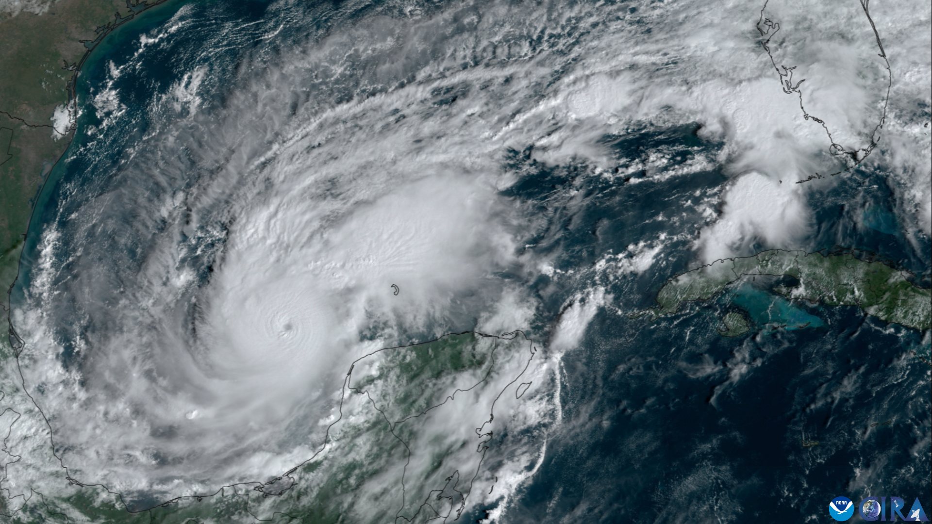
- Isaias made landfall near Destin, Florida, around 8:30 p.m. CT Friday as a Category 2 hurricane with 105-mph sustained winds.
- 560,000+ customers lost power within an hour of landfall across southern Alabama and the western Florida Panhandle — 70% of Escambia County is dark.
- Gov. Ron DeSantis told Floridians to "hunker down," with search-and-rescue and debris teams mobilizing around 3 a.m. CT Saturday.
- The storm was down to 90 mph by the 10 p.m. CT advisory, tracking north toward Alabama — and tornadoes are possible east of the track overnight.
DESTIN, Fla.
Hurricane Isaias came ashore near Destin on Friday night as a Category 2 hurricane, and it didn't take long to make its presence felt. By the time the center had been on land an hour, more than 560,000 customers were without power across southern Alabama and the western Florida Panhandle, according to outage trackers — the kind of instant, sweeping grid failure that only happens when a hurricane's core passes directly over the lines that feed you.
The National Hurricane Center put landfall at about 8:30 p.m. CT (9:30 p.m. ET) Friday, with maximum sustained winds of 105 mph. That makes Isaias the ninth named storm of the 2026 Atlantic season and its first hurricane. It is also worth saying plainly: this could have been worse. Isaias had been a major hurricane hours earlier, and wind shear took some of the top off the storm before it reached the coast — the reason Gov. Ron DeSantis told reporters he was "cautiously optimistic" even as the lights were going out up and down the coast.
The wind numbers tell the story of the evening. A station at Santa Rosa Sound recorded a 116-mph gust with sustained winds of 91 mph. Near Pensacola, a gust hit 100 mph. Pensacola's airport logged its peak gust of 92 mph at 7:09 p.m., and the area's bridges — the lifelines that tie the barrier islands to the mainland — were closed at 3 p.m., hours before the worst of it arrived.
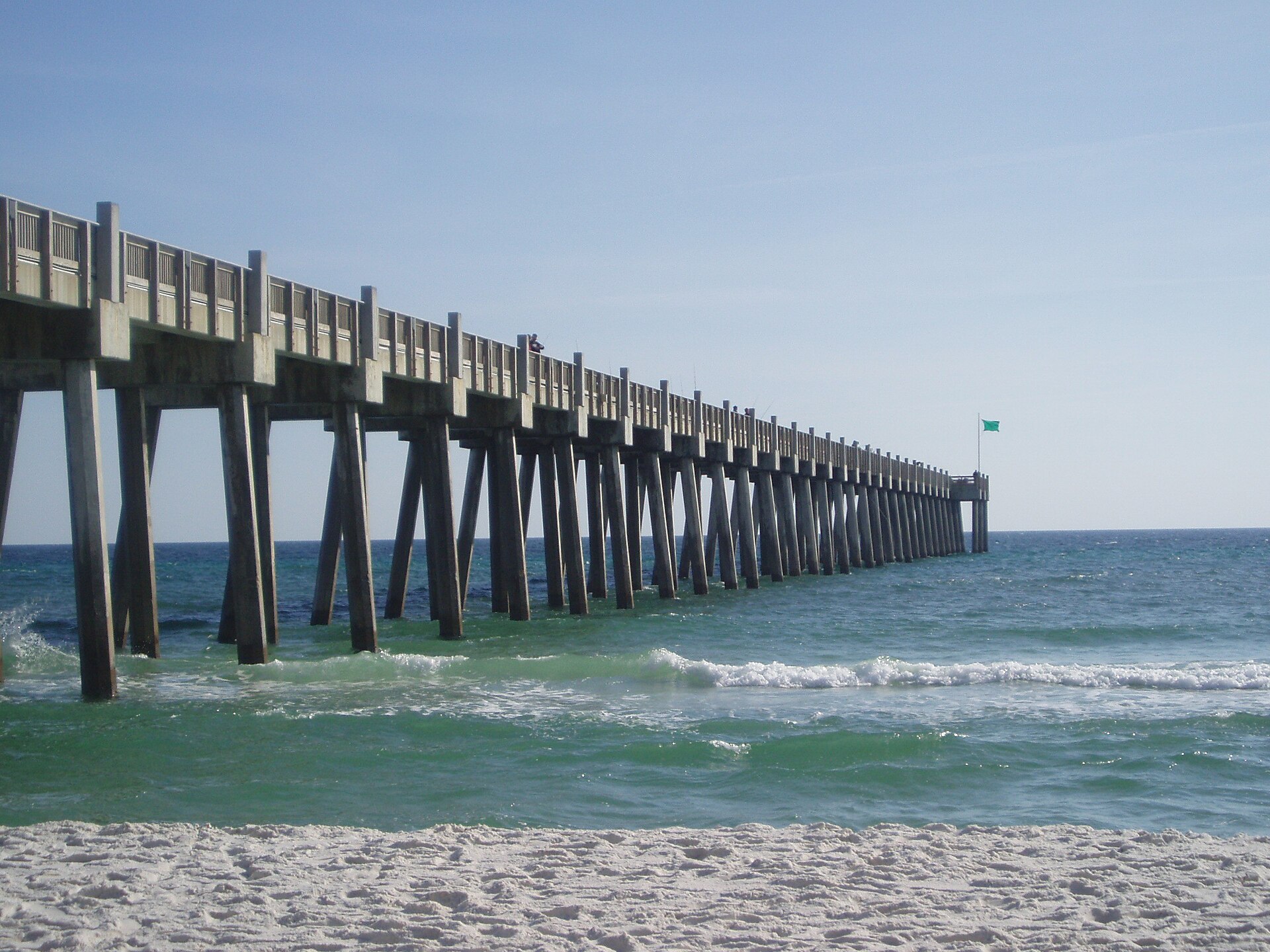
The outages came fast
The blackout numbers are the headline of the night. Within an hour of landfall, the tally topped 560,000 customers across southern Alabama and the western Florida Panhandle. In Escambia County, home to Pensacola, 70% of customers were without power. Liberty County in Florida's Big Bend reported 97% of customers out. Across the state line in Conecuh County, Alabama, 94% were dark. When nine out of ten meters in a county go dead at once, you're looking at weeks of rebuild work for some circuits, not days.
The 10 p.m. CT advisory from the National Hurricane Center showed the storm already weakening over land but still dangerous: maximum sustained winds of 90 mph, the center roughly 45 miles east-southeast of Pensacola, moving north at 20 mph, with a minimum central pressure of 982 millibars. A storm moving that fast at that strength carries its winds well inland — which is exactly what the forecast shows. Isaias is expected to track across Alabama and into the Tennessee Valley on Saturday and Sunday, becoming post-tropical by Saturday, with tornadoes possible east of the track.
The warning picture as of Friday night: a Storm Surge Warning ran from Dauphin Island, Alabama, to the Suwannee River in Florida, and a Hurricane Warning stretched from the Mississippi-Alabama border to the Bay-Gulf County line in Florida. Surge and flash flooding remain the life-threatening hazards even as the winds come down.
DeSantis: "hunker down"
Gov. Ron DeSantis briefed reporters around 9:30 p.m. ET Friday from the state's emergency operations center in Tallahassee, urging Floridians in the storm's path to "hunker down" and stay off the roads. He said search-and-rescue and debris-removal teams would mobilize around 3 a.m. CT Saturday — positioned to move in as soon as the winds drop enough to work safely.
The governor also disclosed that 27 North Florida counties are under a state of emergency, and he credited wind shear for weakening the storm before landfall — the reason the catastrophic scenario, a major hurricane hitting the Panhandle at full strength, did not materialize. His next briefing is scheduled for 8:30 a.m. ET Saturday, when the state expects to have a first real damage picture.
That damage picture is what everyone is waiting for now. The Panhandle has seen this movie before and knows the drill: the wind does the headline damage, but the water and the power losses do the long-term kind. DeSantis's 3 a.m. mobilization timeline says the state expects a serious debris field across the western Panhandle come daylight.

What comes next
Isaias is now an inland problem. The storm's forecast track carries it across Alabama and into the Tennessee Valley through the weekend, weakening to post-tropical status on Saturday. The tornado threat east of the track is the overnight watch item — tropical systems spin off twisters in their outer bands with little warning, and they're hardest to spot after dark.
And then there's Saturday's other big event in the storm's path: No. 2 Georgia at No. 6 Alabama in Tuscaloosa — a game that is not moving despite the hurricane bearing down on the state, even as President Trump canceled his planned Tuscaloosa trip. The Crimson Tide and the Bulldogs will be playing football while the county around them digs out. Our Saturday college football watch guide has the full slate — and yes, the weather is part of the story now.
Isaias arrived with the season's reputation already made — it was a Category 3 just hours before landfall — and leaves the Panhandle with a power grid in ruins and a long cleanup ahead. Saturday morning's light will tell the rest.

Sources · 3 sources
- Pensacola News Journal — Hurricane Isaias updates, Florida impacts and landfall (live), Oct. 9, 2026
- USA Today — Hurricane Isaias landfall updates and forecast (live), Oct. 9, 2026
- Tallahassee Democrat — Live updates: Tallahassee, Florida, Hurricane Isaias impacts, Oct. 9, 2026